


Maps Provide Historical Clarity On National Sovereignty
The Danger Of Living In A GPS Driven World Void Of Maps

A close friend and his wife returned from a recent trip out west and proudly shared the fact that they bought an atlas. Yes, a book of maps. They said that they thoroughly enjoyed themselves, physically reading the maps while turning off GPS and embarking on an entirely different adventure.
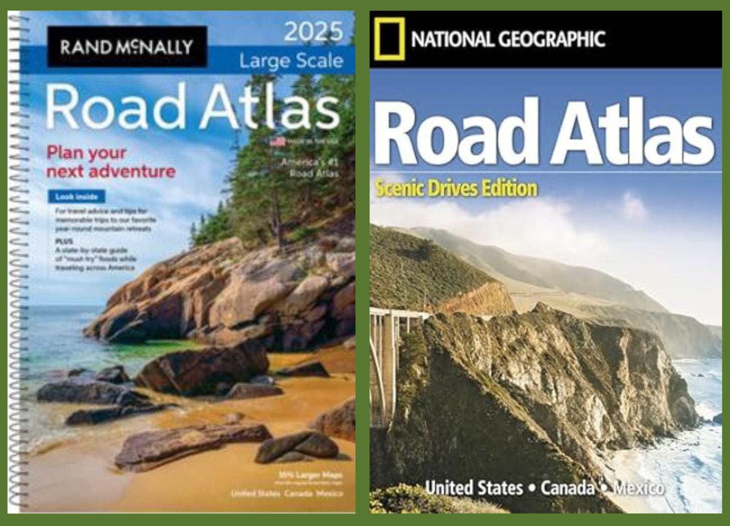
For this couple, the atlas represented a nostalgic return to their past. They could nearly hear their parents arguing in the car about where to turn next as that is how family vacations went down - mom reading the map while dad did his best to navigate through traffic. This couple was literally invigorated and refreshed by a book of maps as the sultry voice of the auspicious GPS bot was silenced and could no longer interrupt their every sentence.
Physical maps are nearly a thing of the past. Our society has practically dismissed maps altogether, claiming hard copies to be an archaic, outlandish way to navigate when all of these “technologies” (aka tracking devices) are readily available.
Who cares about maps right? Well, before you dismiss the topic of maps as boring and irrelevant, we would gently remind you that maps provide historical clarity when it comes to national sovereignty and the boundary lines separating nations. Sovereign nations have rights so maps play a pivotal role in determining a nation’s status.
It is quite possible that Palestine and Ukraine could be in the process of reestablishing their “state” and/or “country” boundary lines. Putin has been saying for months that he just wants NATO to back away so Russia can help Ukraine reestablish certain territorial boundary lines.
In 2023, Putin did something that was apparently shocking to some and quite uninteresting to others. He opened the Tataria archives, while sitting in front of this map. Apparently, these archives had been banned for almost 100 years.

The words Nova Totius Terrarum Orbis Geographica Ac Hydrographica Tabula appear at the top. What does this mean?
The Nova Totius Terrarum Orbis Geographica Ac Hydrographica Tabula or “A New Geographic and Hydrographic Depiction of All the Lands of the World” was composed by Willem Blaeu in Amsterdam in 1630.
This map appears to be the map, or at least quite similar to the one that Putin had on display. However, we have not been able to confirm this to be an exact match. We can only look and compare details.

These next two or three maps closely resemble the map that Putin had on display and are certainly from the same general time period. This one ranked pretty high as one of the closest matches that our team could find.

So how many US colonies had been established with boundary lines in the 1600s? 13 maybe? For example, Virginia was established as a colony in 1607.

This link to the Library of Congress also displays a similar Nova Totius Terrarum Orbis map for those interested in digging deeper.
And this Nova Totius Terrarum Orbis Geographica Ac Hydrographica Tabula map also seemed worth sharing to gain another perspective from this same time period.
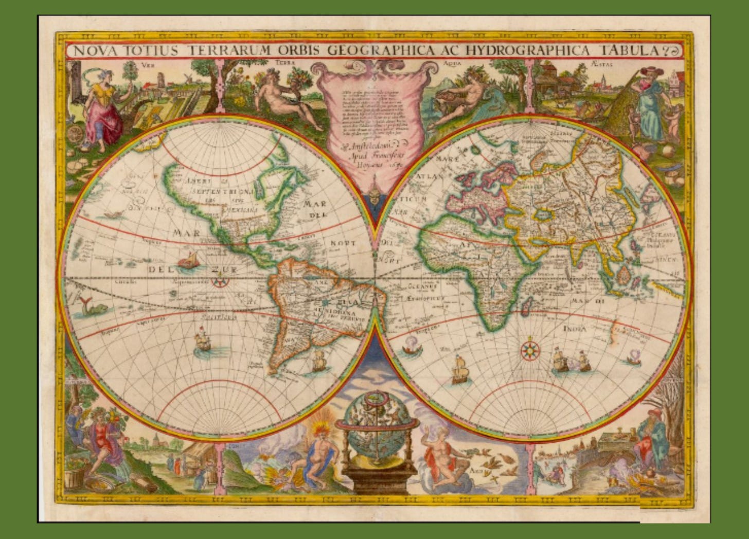
No matter which map version you look at, do you notice something right away? The land mass we know as the United States, with Canada to the north and Mexico to the south, is shaped oddly. Mexico also appears rather insignificant in size. The one other thing that our team noticed was the display of the archangels around the perimeter. Refresh your memory, Fruited Plain readers! What other entity has been putting archangels on display?
The interesting part of this story is that the map from the 1600s that Putin displayed caught the attention of CNN. They even commented that this was absurd of Putin to do such a thing as pull out this archaic map and open up these archives. Check out this short video blurb.
Why do you think CNN cared so much about this map?
And do you remember when the Israel / Hamas “war” broke out in October? It was deemed ludicrous to share these historical maps of Palestine, showcasing the land of Palestine dating back to the pre-British mandate from 1917.
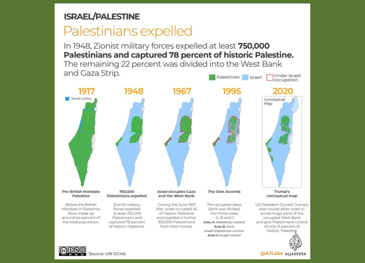
Our team put together this article on the Balfour Declaration of 1917, for those interested in learning more about the historical maps and the relevance to the Israel / Hamas conflict.

In the end, historically accurate maps matter! Why? If it was deemed at a later date that a territory or portion of land was taken over illegally or unlawfully, it would be required by international law to return the land to the rightful owner and reestablish the land’s boundary lines to a date in time prior to the unlawful act occurring.
The question you have to ask yourself is this. Has the US Corporation and its Federal Reserve System been deemed an illegal entity, in and of itself? And if so, would the world be suddenly “driving in reverse,” so to speak, reverting back to an earlier date in history, guided by historically accurate maps to reestablish state and country boundary lines?
And if so, how far back in history are we going? Time will tell!
In the meantime, here are few more of our favorite maps that have caused our team to pause and reflect.
The first is a map that was shared on X by anonymous source, suggesting what the first map might have looked like going back to the creation account found in the book of Genesis. And yes, the big building and what appears to be the Eiffel Tower were not there “in the beginning.”

The second is the map of the United States that was aired in Germany on election night 2020. You are wise to read the captions very carefully. Some maps really matter!

OAN Reports: Seized SCYTL data shows landslide win for Pres. Trump. Alleged server seized by US Army shows Pres. Trump had 410 electoral votes on election night.
Seized data? You don’t say.
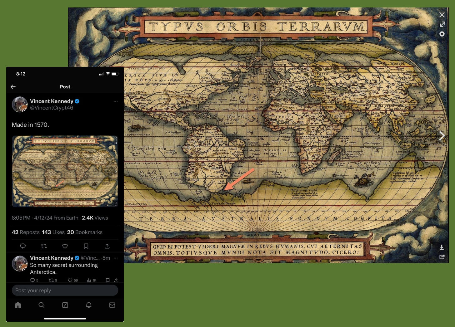
And finally, this gem of a map that was produced in or around 1570 or about 50 years prior to the Nova Totius Terrarum Orbis Geographica Ac Hydrographica Tabula maps. We all suffer from tremendous void of knowledge when it comes to the topic of Antarctica. It is almost as if certain groups or people want the public to forget about the north and south poles.
Are you starting to see the dangers of living in a GPS driven world void of maps?